
Ciudad Azteca station
Metro · B Line B
Neighbouring stations
- BLine BPlaza Aragón Ciudad Azteca Terminus
The story behind the icon
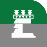
The station icon represents the typical glyph of the Aztec city of Tenochtitlan.
It is one of the 99 subdivisions in the municipality of Ecatepec and is made up of three sections, located to the north-east, almost at the boundary with the municipality of Atenco. Near this neighbourhood is the solar evaporation basin "El Caracol", the main source of water in the municipality; it is one of the last bodies of water of Lake Texcoco.
It is currently used for industrial purposes and to take advantage of the concentration of saline waters coming from the soils of the region.
The Aztecs were one of the Chichimec groups that migrated towards promising Mesoamerica. After a long pilgrimage they settled on an islet within the Tepanec lordship of Azcapotzalco.
The city of Tenochtitlan takes shape around its religious centre, where the Templo Mayor stands along with more than 70 temples dedicated to various deities, all built with wooden finishes and marvellously decorated with many-coloured paintings. From there run four monumental causeways that order the city into four nauhcampan, or quarters.
México-Tenochtitlan became an important centre of trade, with an abundance of goods from many regions. There were gathered religious precincts as well as centres of learning that housed artists, sages and priests. This stage of Mexico's history ends with the fall of the empire of Moctezuma Xocoyotzin before the Spanish conquistadors allied with indigenous enemies of the Mexica empire.